The assassination that triggered World War I happened 102 years ago today 


One hundred and two years ago today, the fate of world history was changed forever. 
Austro-Hungarian Archduke Franz Ferdinand, heir to the throne, and his wife were gunned down on the streets of Sarajevo, Bosnia by a Serbian nationalist. The assassination, and the subsequent political and military upheavals, led to the start of World War I and the decimation of large swathes of Europe a month later.

Over 100 years after the start of WWI, it is still extremely difficult to comprehend just how global a phenomenon the war was. It affected people on every continent and hastened the end of the European empires.  Read more

A Visual History of D-Day

Map of the four day invasion of occupied France

Info board of Operation Neptune

Click and zoom to view images 

Take a Virtual Tour of Washington DC

Washington D.C.

In honor of President’s Day, take a virtual tour of our country’s capital. Follow the link below and begin your tour  courtesy of PBS.

tourlogo.png

The Virtual Tour of Washington DC 

Today marks the 150th Anniversary of the end of the Civil War.


image
Don Troiani's painting depicts Union soldiers drawing up their weapons in salute as the surrendered Confederates march past.

Image courtesy Don Troiani, Historical Art Prints

Battle of Appomattox Courthouse
April 9, 1865
Early on April 9, 1865 the remnants of John Brown Gordon’s corps and Fitzhugh Lee’s cavalry formed a line of battle at Appomattox Court House. Gen. Robert E. Lee was determined to make one final attempt to reach his supplies at Lynchburg and escape Ulysses S. Grant’s ever-tightening noose. At dawn the Confederates advanced, initially gaining ground against Sheridan’s cavalry. The arrival of Charles Griffin’s Federal infantry, however, stopped the advance in its tracks. Lee’s army was now surrounded on three sides. After a brief engagement a Confederate horseman was seen galloping toward Union lines holding aloft a white flag.  Lee had surrendered; the war in Virginia was over.

image
Appomattox courthouse battlefield map

Harried mercilessly by Federal troops and continually cut off from turning south, Lee headed west, eventually arriving in Appomattox County on April 8.  Heading for the South Side Railroad at Appomattox Station, where food supplies awaited, the Confederates were cut off once again and nearly surrounded by Union troops near the small village of Appomattox Court House.  Despite a final desperate attempt to escape, Lee’s army was trapped.  General Lee surrendered his remaining troops to General Grant at the McLean House on the afternoon of April 9.

For more maps, photos and history articles on this critical Civil War battle, visit our Battle of Appomattox Court House page »
Learn More About Civil War Trust’s Map Reprint Policy

CIVIL WAR: OVERLAND CAMPAIGN ANIMATED MAP


One of my weaknesses–MAPS–the older the better. You can imagine my pleasure when I found these animated maps from the Civil War Trust. I think I’ve shared every battle (they’ve mapped out)  here but when I went to visit the site  I didn’t remember posting the Overland campaign; it may be floating around here somewhere. I thought I’d put it up, no harm no foul, besides I think everyone will enjoy this. If you are curious about the others, I have them tagged and categorized with Civil War Trust, interactive, & maps. Enjoy!


The World’s Largest Armies From Antiquity To The Present


NOV. 26, 2014

Mapmaking graphic artist Martin Vargic’s has made an amazing graphic tracking the size of the world’s largest armies at different points in time.

The graphic gives an understanding of the just how mobilized the human race was during World War II — and shows how the size of the wold’s largest armies has shrunk over time as interstate warfare becomes less common and technology surpasses sheer manpower in military importance.

It also gives us a chance to compare the size of some of the largest armies at different points in history with one another: the US had about as many troops in 1950, for instance, as China’s Ming Dynasty had in 1400.

One loaded choice Vargic made is splitting the world between East and West. The graphic doesn’t depict the world’s single biggest army at any given time, but the biggest armies in two halves of a divided and sometimes antagonistic world.

In his research, Vargic drew from Encyclopedia Britannica, British think tank IISS, and Wikipedia. The first project listed on his website is a humorous map showing the Internet’s biggest traffic drivers as countries drawn to scale.

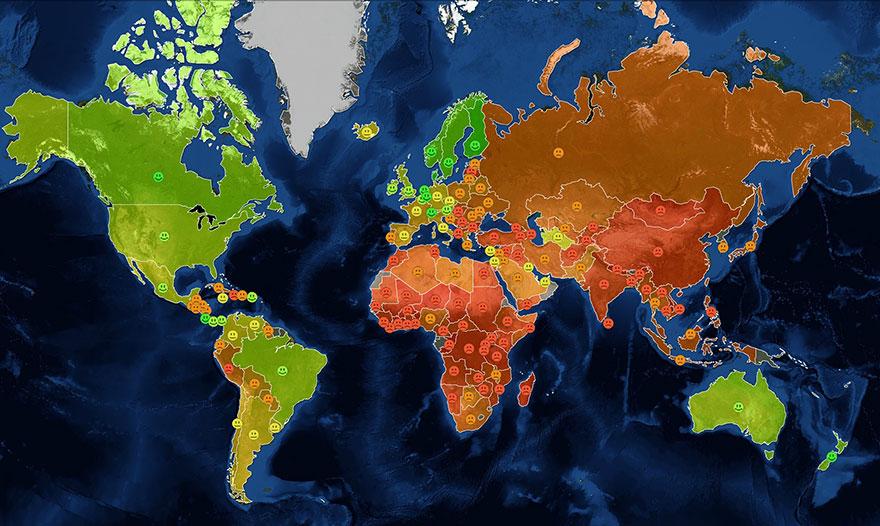
Another project of his shows what would be left of the world should sea levels rise by 250 to 300 feet, which the Slovakian artist said is realistic should the polar ice caps melt completely.

Click map for HiRes

chart military army size history


Via: businessinsider.com

Here Is What The Turkish Border Looks Like While ISIS Besieges Syrian Border Town


Digital Globe, a high-resolution satellite imagery company, released the following image of the Turkish border where refugees are fleeing the bloodshed in Kobani, a Syrian border town currently under siege by the Islamic State.

CNN’s Hala Gorani notes that the photo shows “100s of cars abandoned at Turkey border by refugees fleeing Kobani fighting.”

Read more

Here’s The Massive Scope Of World War I In A Single GIF


One hundred years after the start of World War I, it is still extremely difficult to comprehend just how global a phenomenon the war was. It affected people on every continent and hastened the end of the European empires. 

Reddit user Srirachachacha shared this map showing the amazing spread of the war across the world. The GIF does a fascinating job of distinguishing between the key Allied and Central Powers and their colonies, dominions, and territories. 

4b1rrxf

World War I started off solely as a military conflict between the Austro-Hungarian Empire and Serbia following the killing of Austro-Hungarian Archduke Franz Ferdinand by a Serbian assassin. Through a web of entangling defensive alliances, the conflict quickly morphed into a war that pulled in almost the entirety of the world. 

By the time the war ended, the Russian, Ottoman, Austro-Hungarian, and Prussian Empires had collapsed. The war claimed over 37 million lives, and large swathes of Europe lay in complete destruction. 

Incredibly, only two decades later the world would be poised on the brink of World War II. 
Read more: http://www.businessinsider.com/this-gif-shows-the-scope-of-world-war-one-2014-5#ixzz38w6ym6cC

Here’s The Massive Scope Of World War I In A Single GIF


One hundred years after the start of World War I, it is still extremely difficult to comprehend just how global a phenomenon the war was. It affected people on every continent and hastened the end of the European empires. 

Reddit user Srirachachacha shared this map showing the amazing spread of the war across the world. The GIF does a fascinating job of distinguishing between the key Allied and Central Powers and their colonies, dominions, and territories.  Read more

How Well Do You Know Basic U.S. Geography


No, you may not use Google Maps.


1. Which Great Lake is the red arrow pointing to?

  1. Lake Superior

  2. Lake Ontario

  3. Lake Huron

  4. Lake Michigan

  5. Lake Erie

    Read more

The Stereotype Map Of Every U.S. State — According To British People


Here’s more from our friends in England…
We asked people in BuzzFeed’s U.K. office to tell us what stereotypes they had of every state in the U.S.A. Here are their responses. We’re so terribly sorry, America.

Read more

USAF: Airman Challenge


So, do ya think you have what it takes to be a United States Airman? Well the Air Force is challenging you …if you’re up for it.   😉

Try your hand at the missions undertaken day in and day out by the United States Air Force. Want to play Airman Challenge? Click image to launch the interactive map and play screen, choose your squadron, select your mission, and away you go. Good Luck and have fun! 

Maps of the Battle of Gettysburg


gettysburg-map-s

I Love maps, especially like the two here of the battle of Gettysburg, via Civil War Trust. Here’s the link to the Animated Map of the same battle. Want more? Look under the category Maps. Enjoy!

Field of Gettysburg, July 1st, 2nd & 3rd, 1863 Prepared by T. Ditterline.

[Philada. P. S. Duval & Son lith. 1863]

Scale ca. 1:25,500,. 
Reference: LC Civil War Maps (2nd ed.), 331 
From his Sketch of the battles of Gettysburg . . . New York, C. A. Alvord, 1863. 24 p. 
Oval-shaped map depicting troop and artillery positions, relief by hachures, drainage, roads, railroads, and houses with names of residents. 
Description derived from published bibliography.

Library of Congress Geography and Map Division Washington, D.C. 20540-4650

Click to enlarge

gettysburg-national-military

To Learn More About this Battle Please Visit our Battle Summary Page:  Battle of Gettysburg

Learn More About Civil War Trust’s Map Reprint Policy

Three Confederate prisoners in 1863 July, near...
Three Confederate prisoners in 1863 July, near Gettysburg, Pennsylvania. (Photo credit: Wikipedia)

38 Maps They Didn’t Teach You At School (Part II)


fun-maps-2-3Happiness Map

I’m sharing a few of my favorites. To  see the rest link to the page at the end of this post.

When we [Bored Panda] collected a list of 40 maps that you never would have seen in school, you guys totally loved them, so we’re back with more. If maps are one of the main ways that we understand the world we live in (and how people elsewhere in the world live), then it’s no surprise that people are always coming up with new ways to use them to display information.

Every single one of these maps reveals different fun and interesting facts, from which we can make some interesting inferences. There’s usually no better way to illustrate the economic, social and cultural differences between different parts of the world than by displaying them on a map. Read more

Pilots Map – Bomber Raid, WW II


 Original pilots map – Bomber raid on Cologne, WW II

The Kölner Dom (Cologne Cathedral) stands seem...
The Kölner Dom (Cologne Cathedral) stands seemingly undamaged (although having been directly hit several times and damaged severely) while entire area surrounding it is completely devastated Germany, 24 April 1945. (Photo credit: Wikipedia)


Cologne Cathedral
Cologne Cathedral (Photo credit: szeke)